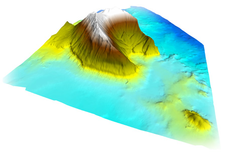
Coastal eco-cartographical studies consist of a series of maritime engineering and marine ecology studies, with their results perfectly structured in a GIS and associated databases for their correct use and exploitation in future projects and studies involving the Spanish coastline.
The basic issues undertaken by HIDTMA are:
- Topographical studies
- 3D bathymetric studies
- Analysis of tides
- Morphology of seabeds
- Coastal dynamics and classification of beaches
- Coastal ground utility plan
- Natural heritage
- Cultural heritage
- Marine biology studies
- Fisheries studies
- Water quality and sediments
- Ecological evaluation of the coastline
- GIS and associated databases

Outstanding project
COASTAL ECO-CARTOPGRAPHY STUDIES
List of Eco-cartographies carried out by HIDTMA to-date:
- Eco-cartography of the Islands of Lanzarote, Graciosa and Alegranza. 2000- 2001
- Eco-cartography of the Islands of Fuerteventura and Lobos. 2003-2004
- Eco-cartography of the provinces of Alicante and Valencia. 2006 – 2007
- Eco-cartography of the provinces of Granada, Almería and Murcia. 2008 – 2009
- Eco-cartography of the province of Castellón. 2009 – 2010
To read more about Coastal eco-cartography studies, visit our blog ECOCARTOGRAFIAS.COM

